|
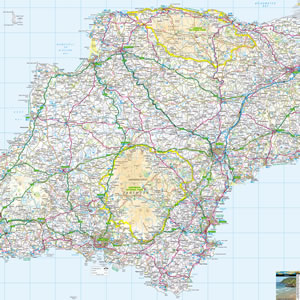
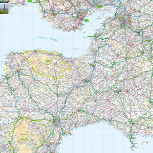
The county of Dorset is located in the West Country, south of Somerset, to the west of Hampshire and to the east of Devon and Cornwall. The Jurassic Coast is a World Heritage site. The geology - and beauty - of its golden beaches and chalk cliffs are unique. Elsewhere are quaint towns, National Trust castles, tiny islands, dairy farms, interesting museums and classic steam railways. |
Map of Dorset including:
- Dorset and the Jurassic Coast.
- Portland Bill, Weymouth and Chesil Beach.
- Isle of Purbeck, Swanage, Wareham, Poole Harbour and Brownsea Island.
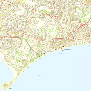
- Bournemouth.
- South West Coast Path, including Lyme Regis, Durdle Door and Lulworth Cove.
- Dorchester, Shaftesbury and Blandford Forum.
|
This map is useful for:
- Tourist Information and Sightseeing.
- Group Travel Planning.
- Dorset Hotel Holidays or Short Breaks.
- Nearby Cottage Holidays.
- Dorset outdoor activities, including walking, hiking and cycling.
- Download and view this map offline on your PC, Laptop, iPad, iPhone or Android Mobile Phone or Tablet.
|
|
|
|
|
|
|
|
|
|