|
The Lake District is a region in North West England. It is a huge area of lakes, tarns and waters, connected by mountains, fells and woodland. It's England's biggest National Park. Visitors often stay at a town like Keswick or Ambleside, then explore lakes like Windermere, Coniston Water and Derwentwater. Walking, hiking, cycling, climbing and watersports are all popular. |
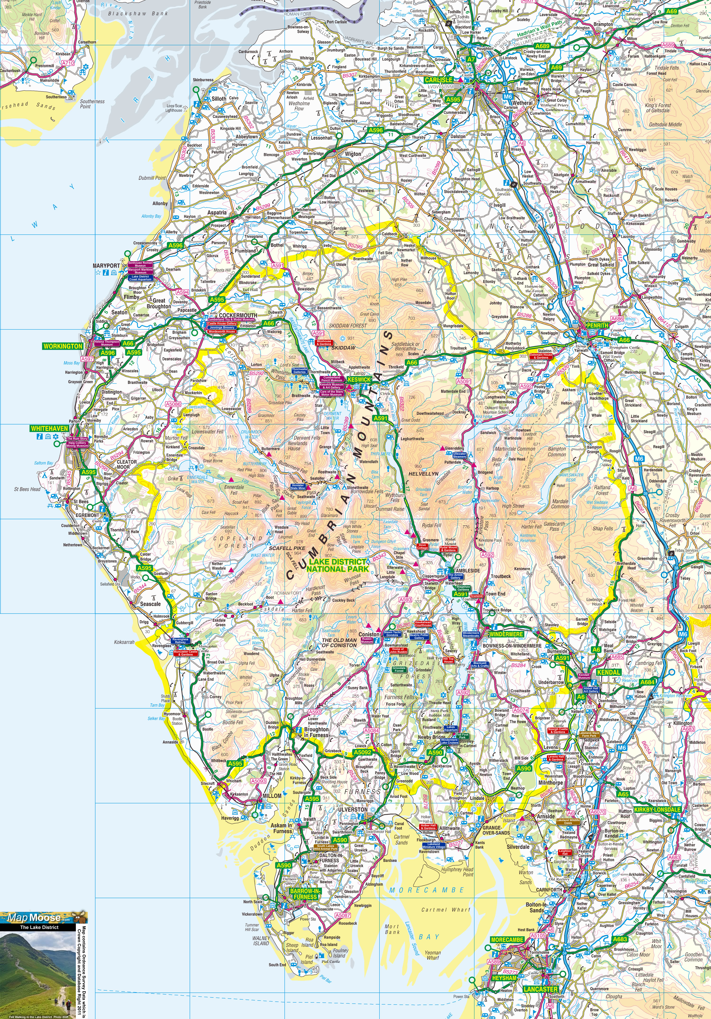
Map of the Lake District including:
- Lake District National Park
- Windermere and Ambleside
- Ullswater and Penrith
- Keswick and Derwent Water
- Carlisle and the M6 Motorway
- Lake District Coast and Whitehaven
- Major Tourist Attractions in the Lake District
|
This map is useful for:
- Lake District Tourist Information
- Route Planning
- Activity Planning including Fell Walking.
- Lake District Cottage Holidays and Short Hotel Breaks.
- Lake District Days Out
- Download and view this map offline on your PC, Laptop, iPad, iPhone or Android Mobile Phone or Tablet.
|
|
|
|
|
|
|
|
|
|