|
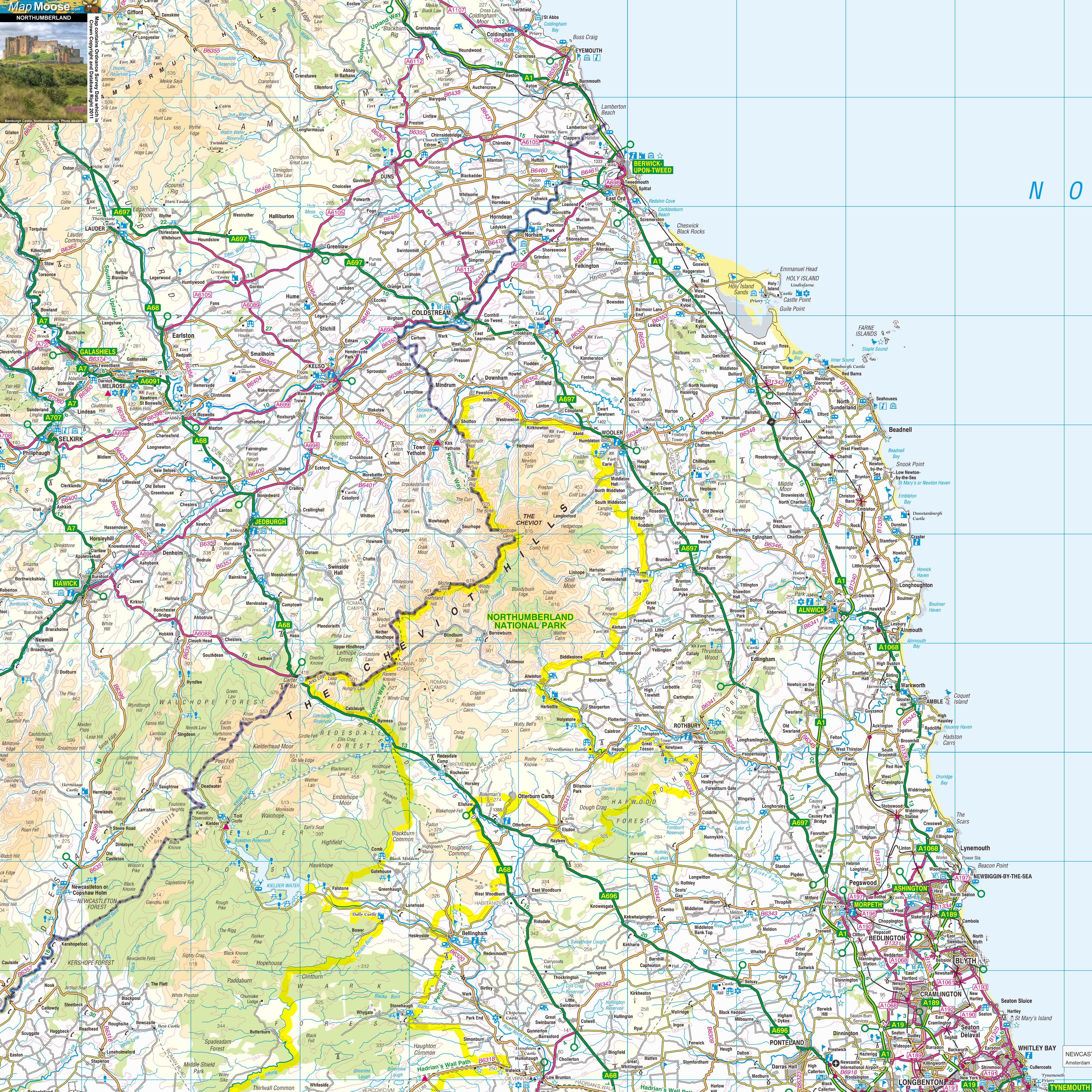
Northumberland is a county in North-East England, on the border with Scotland. It includes Hadrian's Wall, a World Heritage Site. Lindisfarne ("Holy Island") is a tidal island with an ancient priory. Alnwick is a pretty town with a huge castle. The hills of Northumberland National Park offer walking routes and local B&Bs. |
Map of Northumberland including:
- Cheviot Hills and Northumberland National Park.
- Kielder Water and Kielder Forest
- Lindisfarne Holy Island and the Farne Islands.
- Morpeth, Alnwick, Coldstream, Berwick upon Tweed, Kelso, Wooler, Hawick.
- Bamburgh Castle, Dunstanburgh Castle.
- Devils Causeway.
|
This map is useful for:
- Tourist Information and Sightseeing.
- Northumberland Cottage Holidays.
- Activity Planning.
- Northumberland Days Out.
- Download and view this map offline on your PC, Laptop, iPad, iPhone or Android Mobile Phone or Tablet.
|
|
|
|
|
|
|
|
|
|