|
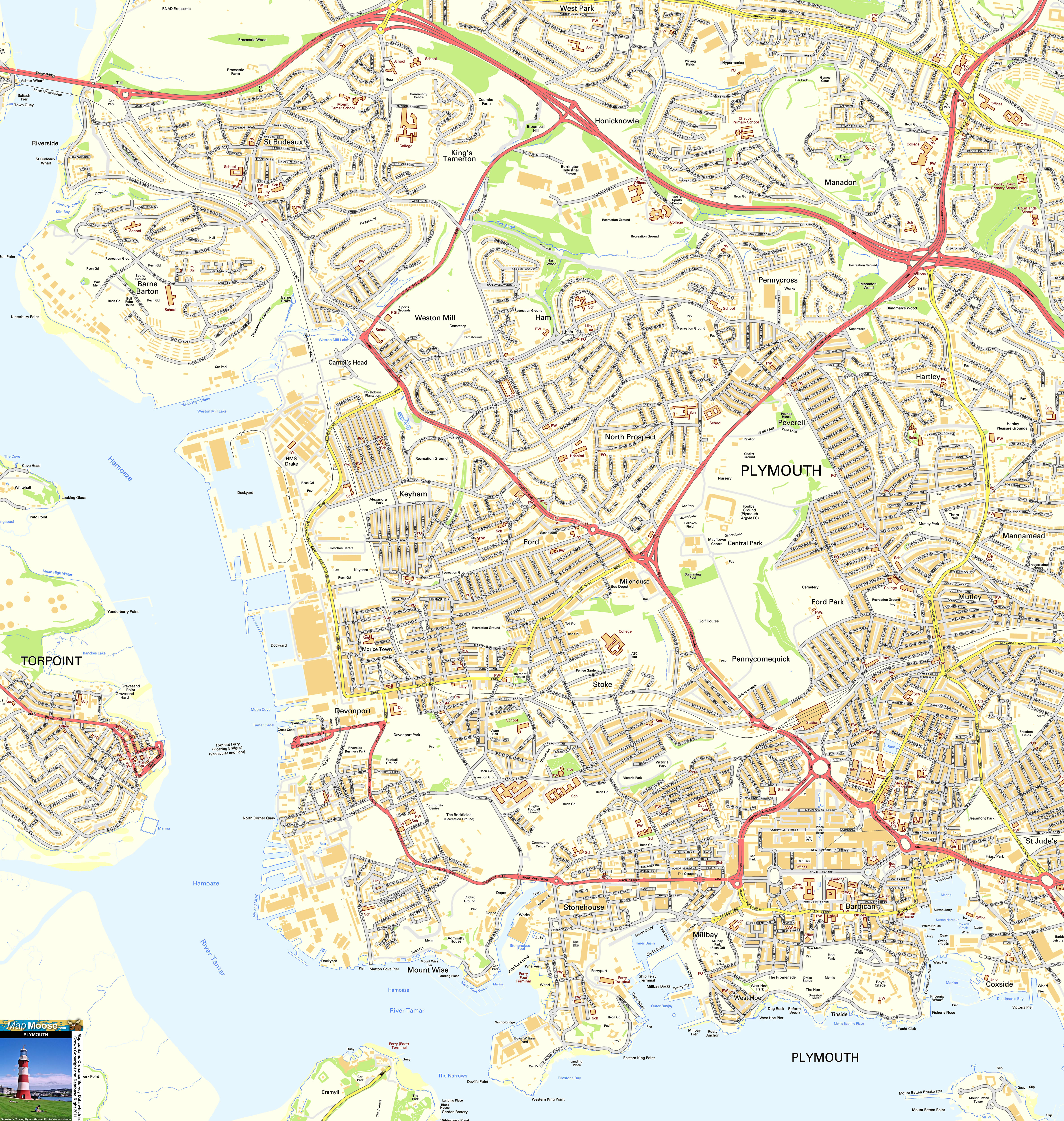
Plymouth is a maritime city on England's south west coast, with a huge natural harbour. In the Barbican area are the steps where the Pilgrim Fathers boarded the Mayflower and left the UK. Now it's home to the National Marine Aquarium. There are plenty of shops, restaurants and museums, as well as the Plymouth Gin Distillery. |
Map of Plymouth including:
- Plymouth Hoe and Smeaton Tower.
- Coxside, St Judes, Stonehouse, Mount Wise, Stoke, Millbay, Keyham, North Prospect.
- River Tamar, Torpoint Ferry, Tamar Bridge
- Royal Parade and City Centre
- A38
|
This map is useful for:
- Tourist Information and Sightseeing.
- Plymouth Hotel Holidays or Short Breaks.
- Devon or Cornwall Cottage Holidays.
- Plymouth Shopping Trips.
- Download and view this map offline on your PC, Laptop, iPad, iPhone or Android Mobile Phone or Tablet.
|
|
|
|
|
|
|
|
|
|