|
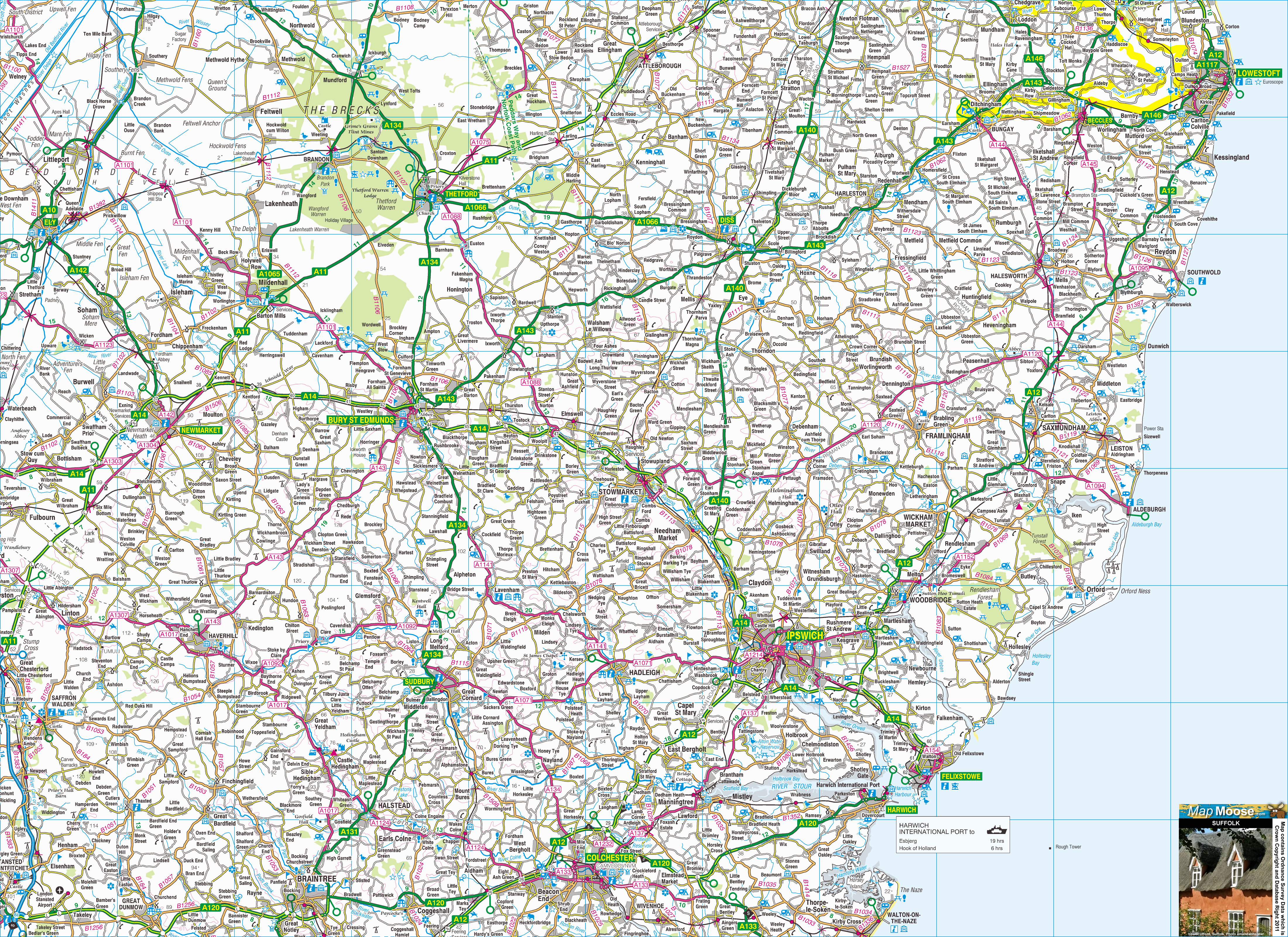
Suffolk is a county located in East Anglia and it shares the Broads' rivers and lakes with Norfolk. The shoreline between Lowestoft and Southwold is called the "Sunrise Coast". Ipswich is the county town; there are also Victorian towns like Felixstowe, market towns like Bury St Edmunds and medieval villages like Lavenham. |
Map of Suffolk including:
- Suffolk and the Coast.
- Lowestoft, Beccles, Bury St Edmunds, Sudbury, Ipswich, Woodbridge, Southwold, Aldeburgh, Saxmundham, Framlingham.
- Stowmarket, Lavenham, Orford, Snape Maltings, Hadleigh.
- A14, A140, A12, A11 Major Roads.
|
This map is useful for:
- Tourist Information and Sightseeing.
- Visiting Suffolk for a Hotel Break or a Cottage Holiday.
- Group Travel Planners.
- Route Planning such as Cycling.
- Activity Planning such as Walking & Hiking.
- Download and view this map offline on your PC, Laptop, iPad, iPhone or Android Mobile Phone Tablet.
|
|
|
|
|
|
|
|
|
|