|
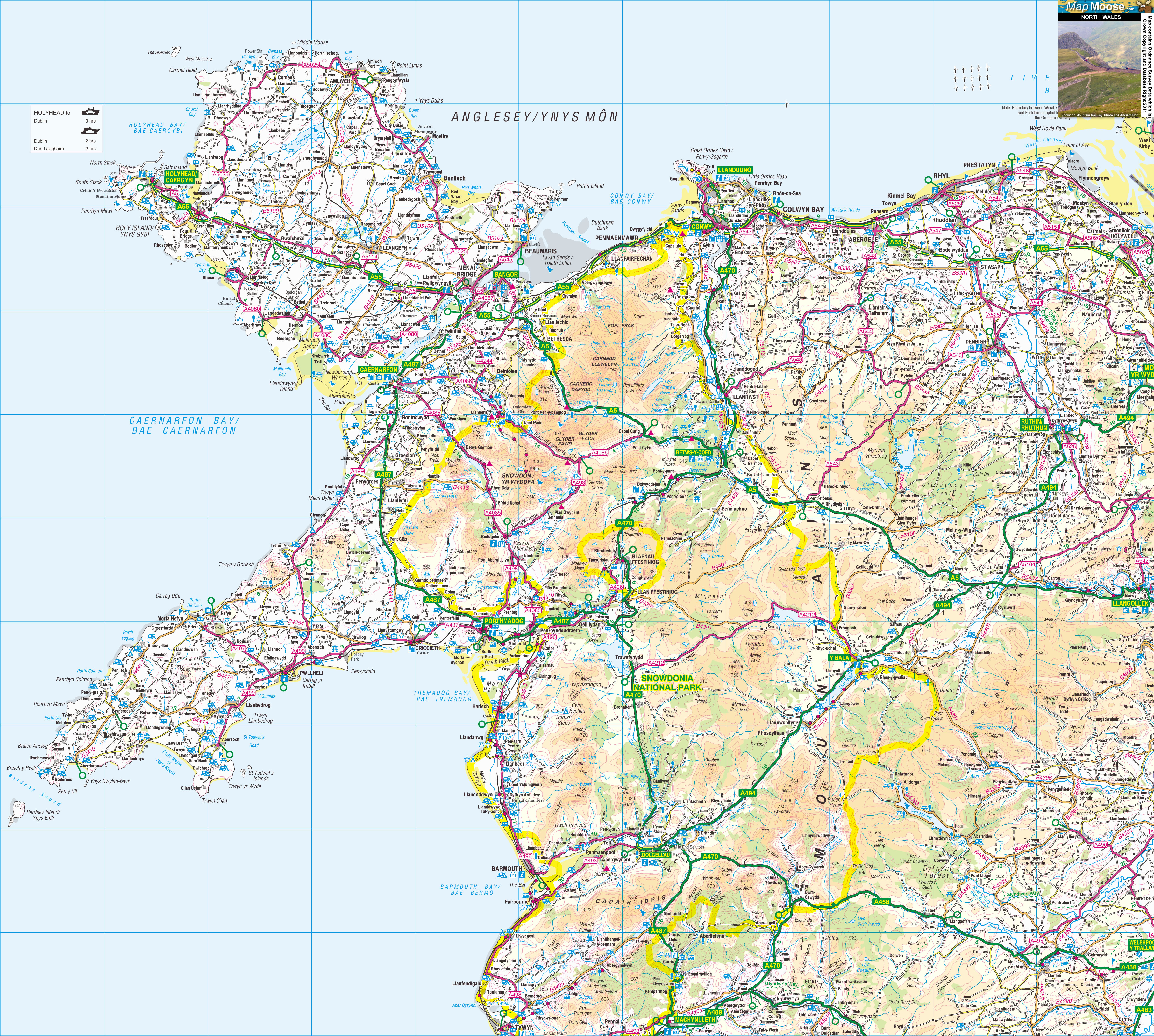
North Wales is at the Northern end of the country of Wales. Visit Victorian seaside resorts like Llandudno and Bangor. Anglesey island lies just off the north coast; its Holyhead port offers ferries to Dublin. Snowdonia National Park includes Snowdon, Wales' tallest mountain. The village of Blaenau Ffestiniog has the Llechwedd Slate Caverns, and a heritage railway. |
Map of North Wales including:
- North Wales Coast including Llandudno, Conwy and Colwyn Bay.
- Anglesey, Holyhead and the Menai Bridge.
- Bangor and Caernarfon.
- LLeyn Peninsula.
- Snowdonia National Park and Betws-y-Coed.
- Blaenau Ffestiniog and Porthmadog.
|
This map is useful for:
- Tourist Information and Sightseeing.
- Hotel Holidays or Short Breaks.
- North Wales Cottage Holidays.
- Route Planning.
- Activity Planning such as Cycling, Sailing and Walking.
- Download and view this map offline on your PC, Laptop, iPad, iPhone or Android Mobile Phone or Tablet.
|
|
|
|
|
|
|
|
|
|