|
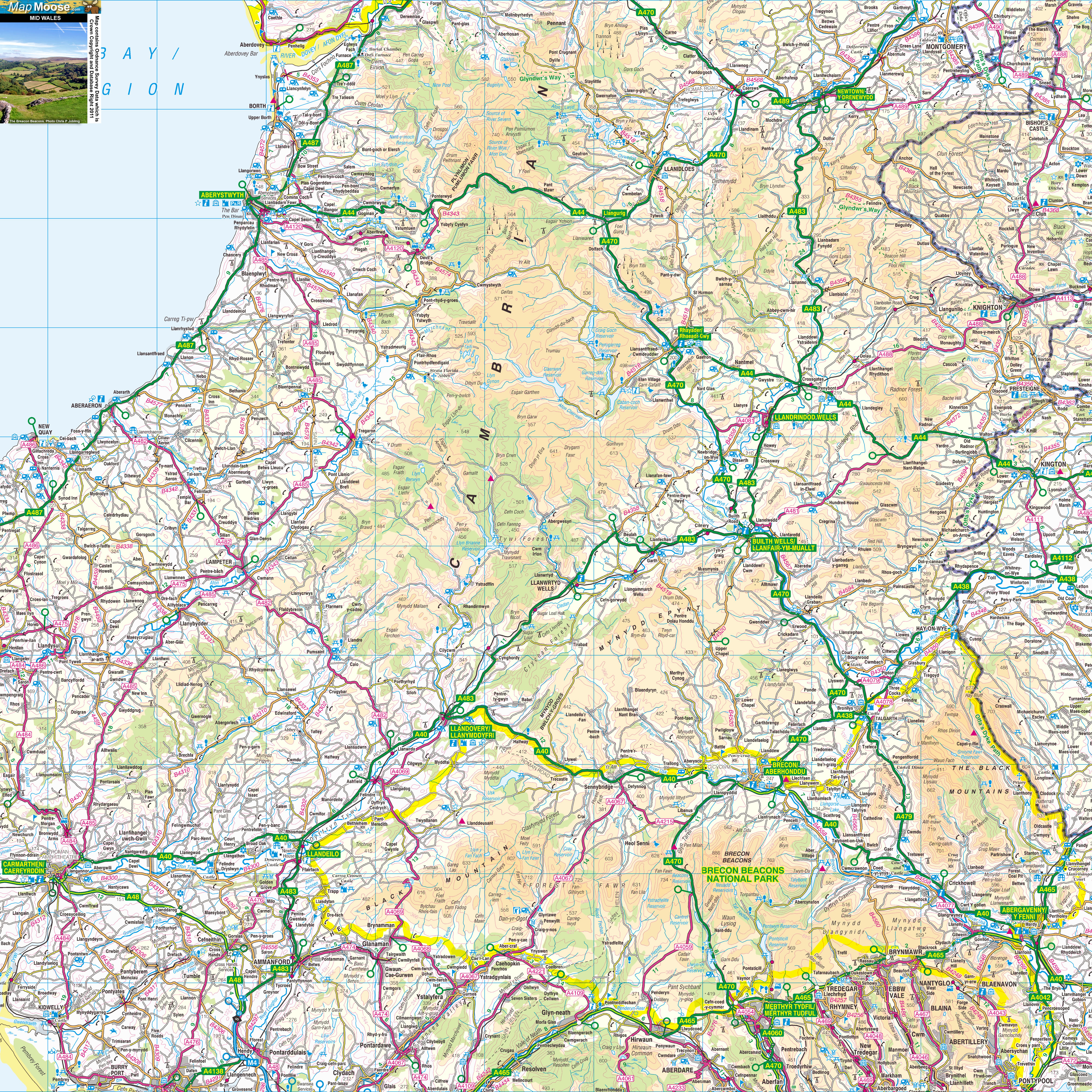
Mid Wales is a region of central Wales and boasts mountains, small towns and amazing scenery. Aberyswyth is a traditional student town on the Ceredigion coast. The Brecon Beacons National Park offers walking and cycling. Llandovery has a regular market - as does Abergavenny, next to the Black Mountains. It's often called the "Gateway to South Wales". |
Map of Mid Wales including:
- The Cambrian Hills.
- Brecon Beacons.
- The Black Mountains.
- Aberystwyth and Camarthen.
- Llandovery, Builth Wells and Llandrindod Wells.
- Abergavenny.
|
This map is useful for:
- Tourist Information and Sightseeing.
- Hotel Holidays or Short Breaks.
- Mid Wales Cottage Holidays.
- Route Planning.
- Activity Planning such as Cycling, Sailing and Walking.
- Download and view this map offline on your PC, Laptop, iPad, iPhone or Android Mobile Phone or Tablet.
|
|
|
|
|
|
|
|
|
|