|
The North Yorkshire Moors is a National Park in Northern England. On the east coast, cliffs watch over the North Sea. There are old towns like Robin Hood's Bay. Inland, right-of-way walking routes cover 1400 miles. Hiking, cycling and horse riding are popular. Explore abbey ruins and ride heritage railways. |
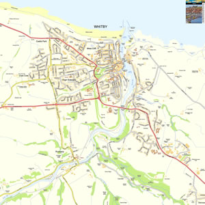
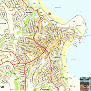
Map of the North York Moors including:
- North Yorkshire Moors National Park.
- Pickering, Helmsley,
- North Yorkshire Coast, Whitby, Scarborough, Bridlington, Filey.
- North York Moors Railway.
- Vale of York.
|
This map is useful for:
- North York Moors Tourist Information.
- Route Planning.
- Activity Planning including Walking.
- Cottage Holidays and Short Hotel Breaks.
- Day Trips and Days Out.
- Download and view this map offline on your PC, Laptop, iPad, iPhone or Android Mobile Phone or Tablet.
|
|
|
|
|
|
|
|
|
|