|
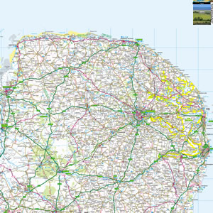
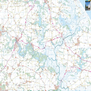
The Southern Broads are a part of the The Broads National Park in the eastern part of the counties of Norfolk and Suffolk. In total, there are seven navigable rivers, plus plenty more lakes and marshes. Join a cruise, or rent a craft yourself, and join the yachts, boats and kayaks on the water. Look out for rare bird species, or for the family pubs lining the riverbanks. |
Map of the Southern Broads including:
- The main rivers of the Yare, Waveney and Chet
- Beccles, Brundall, Loddon, and Reedham.
- Major Broads including Oulton Broad and Rockland Broad.
- Norwich to Lowestoft.
- Major Tourist Attractions including Somerleyton Hall, Burgh Castle, Pettitts Animal Adventure Park.
|
This map is useful for:
- Tourist Information.
- Route Planning.
- Southern Broads Boating Holidays.
- Southern Broads Cottage Holidays.
- Fishing, Canoeing, Cycling, Walking.
- Days Out around the Southern Broads.
- Download and view this map offline on your PC, Laptop, iPad, iPhone or Android Mobile Phone or Tablet.
|
|
|
|
|
|
|
|
|
|