|
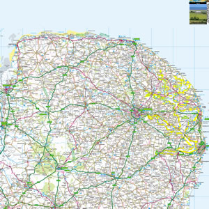
The Norfolk Broads are a National Park in Eastern part of the counties of Norfolk and Suffolk. There are seven navigable rivers, plus plenty more lakes and marshes. Join a cruise, or rent a craft yourself, and join the yachts, boats and kayaks on the water. Look out for rare bird species, or for the family pubs lining the riverbanks. |
Map of the Norfolk Broads including:
- The main rivers of the Bure, Ant and Thurne
- Wroxham - the capital of the Broads
- Major Broads including Barton Broad, Hickling Broad, Ranworth Broad, Salhouse Broad, South Walsham Broad.
- Broadland Villages including Horning, Ranworth, Potter Heigham, Stalham, Thurne, Neatishead.
- Major Tourist Attractions including BeWILDerwood.
|
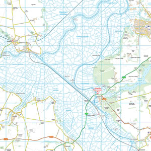
This map is useful for:
- Tourist Information.
- Route Planning.
- Norfolk Broads Boating Holidays.
- Norfolk Broads Cottage Holidays.
- Fishing, Canoeing, Cycling, Walking.
- Days Out around the Norfolk Broads.
- Download and view this map offline on your PC, Laptop, iPad, iPhone or Android Mobile Phone or Tablet.
|
|
|
|
|
|
|
|
|
|